A good drone for mapping and 3D modeling offers stable flight, even in windy conditions, ensuring clear and sharp images. It should have a high-resolution camera, ideally over 20 megapixels, to capture detailed textures and precise data. Long flight times help cover large areas efficiently, while autonomous flight features and obstacle avoidance keep your missions smooth. Durable builds and reliable connectivity protect against failures. Want to discover how to choose the best drone for your project?
Key Takeaways
- Stable flight performance with gimbal-mounted cameras ensures sharp, consistent images for accurate mapping.
- High-resolution sensors (20+ MP) capture detailed textures and precise topographical features.
- Extended flight times maximize area coverage, reducing the number of flights needed.
- Autonomous flight and obstacle avoidance improve route accuracy and safety in complex environments.
- Durability and reliable connectivity ensure continuous operation and seamless data transfer in challenging conditions.
Drones have revolutionized the way we capture and analyze landscapes, making mapping and 3D modeling more efficient and accurate than ever before. When choosing a drone for these tasks, you need to consider key features that directly impact the quality of your results. Two critical factors are drone stability and camera resolution. Stability is essential because it guarantees your drone remains steady during flight, which directly affects image sharpness and consistency. If the drone wobbles or shifts unexpectedly, your photos may become blurry or misaligned, complicating the stitching process in 3D modeling. Look for models with advanced stabilization systems, such as gimbal-mounted cameras and robust flight controllers, to maintain smooth, steady footage even in windy conditions.
Camera resolution is equally vital. High-resolution cameras capture more detail, which is essential for creating precise maps and detailed 3D models. When your images contain more pixels, you can generate finer textures and more accurate topographical features. Opt for drones equipped with cameras that offer at least 20 megapixels or higher, especially if your projects require detailed surface analysis or close-up inspections. Additionally, consider the camera’s sensor size; larger sensors typically produce better image quality, especially in low-light conditions. The combination of high resolution and good sensor quality guarantees your data has the clarity needed for accurate modeling and mapping.
Beyond stability and camera resolution, other features contribute to a drone’s suitability for mapping and 3D modeling. Flight time matters because longer flights allow you to cover larger areas without frequent interruptions, improving efficiency. A drone with GPS and autonomous flight capabilities can follow pre-planned routes, reducing manual control errors and ensuring consistent coverage. Obstacle avoidance sensors help prevent crashes during complex missions, protecting your equipment and ensuring data integrity. Additionally, advanced flight planning tools can streamline your workflow by optimizing flight paths and data collection strategies. Incorporating real-time data processing capabilities can further enhance the accuracy of your outputs by allowing immediate analysis during flights. Moreover, reliable connectivity ensures seamless control and data transfer during extensive mapping missions, reducing the risk of data loss. Ensuring your drone has robust durability is also crucial, especially when operating in challenging environments or over rough terrains, to avoid equipment failures that could compromise your data collection.
Ultimately, the best drone for mapping and 3D modeling balances stability, camera quality, flight duration, and intelligent flight features. You should prioritize models that provide smooth, stable footage, high-resolution imagery, and reliable flight performance. When you select a drone with these qualities, you’ll produce more accurate, detailed maps and models, saving time and reducing post-processing efforts. As you refine your equipment choices, keep in mind that investing in the right drone considerably enhances the quality of your mapping projects, making your workflows more efficient and your results more precise.

MSMV High-Resolution 4K HD Camera Drone, Wireless RC Toys for Boys Girls, One Button Return, Emergency Stop, Headless Mode, 360° Flips, 2 Batteries & Carrying Case for Kids Adults Beginners, Black
This MSMV drone with camera is fitted with high-resolution 4K HD camera. As practical 4K drones with camera…
As an affiliate, we earn on qualifying purchases.
As an affiliate, we earn on qualifying purchases.
Frequently Asked Questions
What Are the Legal Restrictions for Drone Mapping in Different Regions?
You need to understand that legal restrictions for drone mapping vary across regions. To stay compliant, you must follow regional regulations, such as obtaining necessary permits, registering your drone, and respecting no-fly zones. Always check local laws before flying, as legal compliance guarantees you avoid fines or confiscation. Being aware of these rules helps you operate safely and responsibly, making your mapping projects smooth and trouble-free.
How Does Weather Affect Drone Mapping Accuracy?
Weather patterns can dramatically impact your drone’s mapping accuracy. Sudden rain, fog, or high winds can disrupt flight stability, leading to blurry images or data gaps. Additionally, changing temperatures affect sensor calibration, causing inaccuracies in your 3D models. You might think it’s safe to fly, but unpredictable weather can silently sabotage your project—so always check forecasts, stabilize sensors, and choose ideal conditions to guarantee precise, high-quality results.
What Are the Best Batteries for Long Mapping Sessions?
For long mapping sessions, you should choose batteries with high capacity and excellent power efficiency. Look for lithium-polymer (LiPo) batteries, as they provide longer battery life and consistent power output. Opt for batteries with a higher mAh rating, which extends flight time, and guarantee they’re compatible with your drone’s specifications. Properly maintaining and balancing your batteries also helps maximize their power efficiency, giving you more flight time for detailed mapping and 3D modeling.
How to Ensure Data Privacy During Drone Surveys?
You can guarantee data privacy during drone surveys by implementing strong privacy protocols and data encryption. While some might worry about the complexity, these measures are straightforward with the right tools. Use encrypted storage and transmission for your data, limit access to authorized personnel, and follow local regulations. This approach safeguards sensitive information, giving you peace of mind while capturing accurate mapping and 3D models.
What Are the Costs Involved in Professional Drone Mapping?
The costs involved in professional drone mapping include equipment, software, and operational expenses. You should do a thorough cost analysis to understand potential investments, such as high-quality drones, cameras, and processing tools. Budget planning helps allocate funds effectively, considering licensing, maintenance, and training. Keep in mind that while initial costs can be significant, quality data and efficient workflows ultimately save money and improve your mapping accuracy.
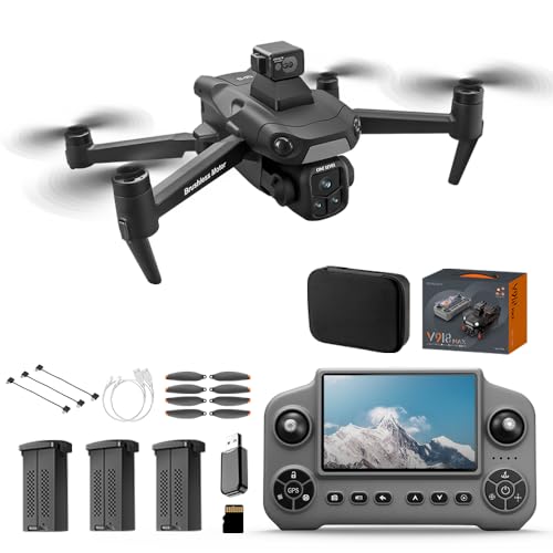
V918 GPS Drone with 8K Camera for Adults, RC Drones with 5 inch HD Screen, 90 Mins Flight Time, 3KM Long Control Range, 360° Obstacle Avoidance, Headless Mode, Auto Return, Circle Fly and Follow Me, Lightweight and Foldable Quadcopter for Beginner Gifts Toy, Under 249g
【Drones with 8K Camera & 360° Obstacle Avoidance】Our V918 drones with camera for adults 8k are equipped with…
As an affiliate, we earn on qualifying purchases.
As an affiliate, we earn on qualifying purchases.
Conclusion
Choosing the right drone for mapping and 3D modeling means you get what you pay for, so don’t cut corners. Look for features like high-resolution cameras, stable flight, and good battery life. Remember, it’s not just about the shiny hardware but how you use it. When you pick wisely, you set yourself up for success. In the end, it’s the details that make the difference—so don’t forget to dot your i’s and cross your t’s.
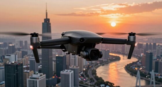
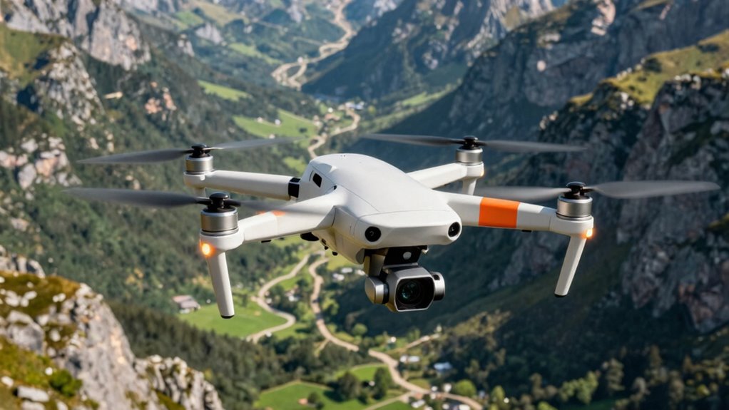
professional 3D mapping drone
As an affiliate, we earn on qualifying purchases.
As an affiliate, we earn on qualifying purchases.
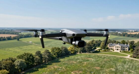
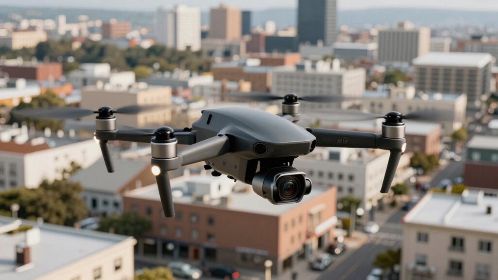
drone with gimbal stabilization for surveying
As an affiliate, we earn on qualifying purchases.
As an affiliate, we earn on qualifying purchases.