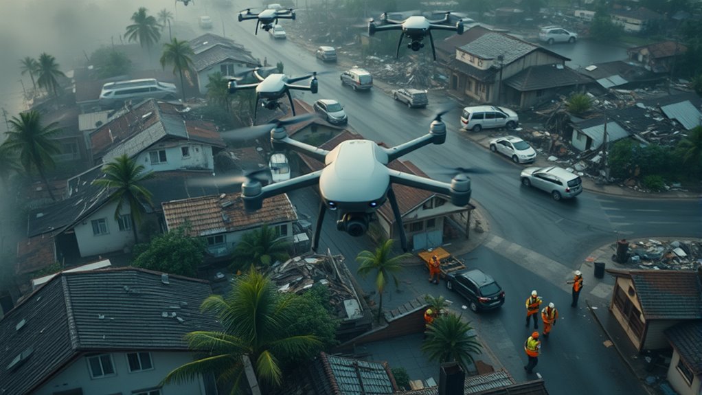

Drones play a vital role in disaster response by offering rapid, precise assistance after hurricanes and earthquakes. They provide real-time data to help you assess damage, locate survivors, and identify hazards quickly. Drones can reach inaccessible areas, increasing safety and efficiency for rescue teams. They also support maritime surveillance and environmental monitoring, ensuring nothing is overlooked. If you’re curious about how this technology is transforming disaster relief, keep exploring what’s possible.
Key Takeaways
- Drones provide rapid, real-time data to assist rescue efforts after hurricanes and earthquakes.
- They identify hazards like debris, oil spills, and stranded vessels in affected water areas.
- Drones assess environmental damage and locate injured wildlife without risking human safety.
- They enhance coordination by relaying live footage, improving rescue efficiency across various terrains.
- Advanced sensors and AI enable autonomous operations, accelerating disaster response and recovery efforts.
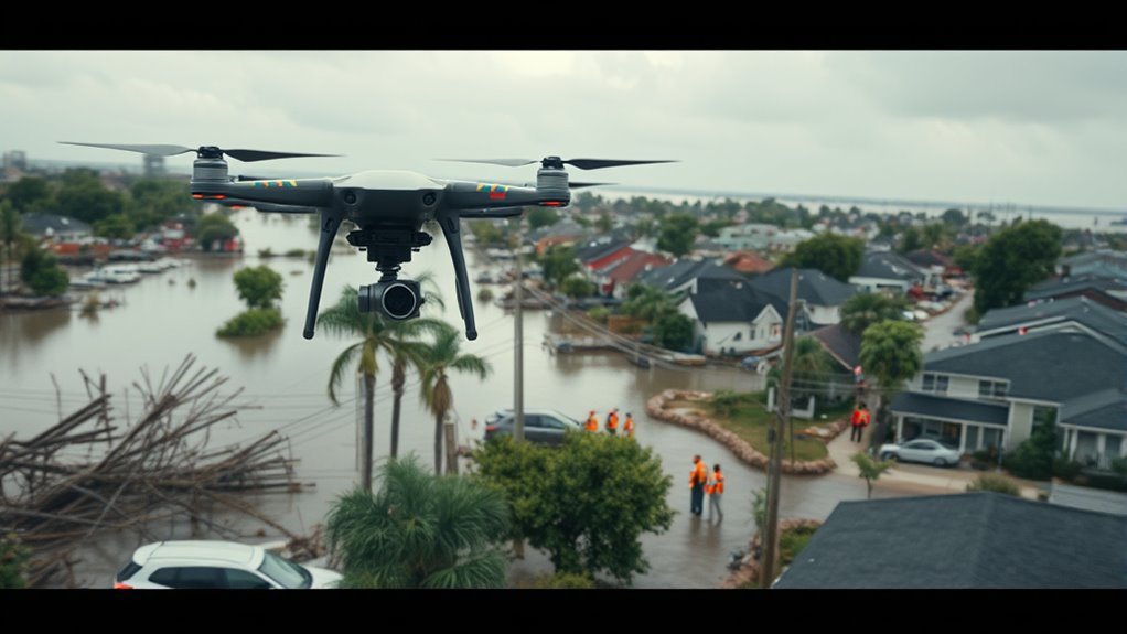
Have you ever wondered how technology is transforming disaster response? Drones have become a game-changer, offering rapid, precise assistance when disaster strikes. After hurricanes and earthquakes, traditional methods can be slow or limited, but drones fill those gaps by providing real-time data that helps responders act quickly and effectively. One of the key ways drones assist is through maritime surveillance. When a hurricane hits coastal areas, it often causes dangerous conditions at sea, with floating debris, oil spills, or stranded vessels that threaten lives and the environment. Drones equipped with cameras and sensors can quickly scan large stretches of water, identifying hazards and guiding rescue boats or cleanup crews. They can monitor the extent of flooding along coastlines or riverbanks, providing critical insights that save time and resources. Since drones can reach places inaccessible to boats or helicopters, they enhance the safety of rescue operations and help prioritize areas needing urgent attention. Additionally, the use of advanced sensors allows drones to collect more detailed environmental data, further improving response efforts.
Beyond maritime surveillance, drones are also instrumental in wildlife monitoring during and after disasters. Hurricanes and earthquakes can devastate ecosystems, displacing animals and destroying habitats. Drones enable conservationists and responders to assess damage to wildlife populations without disturbing them further. With their high-resolution cameras and thermal imaging, drones can track animal movements, locate stranded or injured wildlife, and monitor their recovery over time. This capability is vital because it helps guarantee that rescue efforts are targeted and effective, preventing further ecological harm. By providing a bird’s-eye view of affected areas, drones facilitate a thorough understanding of the landscape, which is essential for planning long-term recovery efforts. They allow responders to gather data swiftly, often in conditions too dangerous or inaccessible for humans, making certain that no animal or ecosystem is overlooked.
Using drones also enhances coordination among different agencies involved in disaster response. They can relay live footage to command centers, helping teams coordinate rescue, relief, and environmental efforts seamlessly. Their ability to operate in varied terrains—urban ruins, forests, or open water—means they’re adaptable tools that improve the overall efficiency of disaster management. As technology advances, drones are increasingly equipped with sophisticated sensors and AI, making them smarter and more autonomous. This progress means faster deployment, better data collection, and more precise decision-making during critical moments. In essence, drones are transforming disaster response by offering innovative solutions for maritime surveillance, wildlife monitoring, and beyond, ensuring quicker, safer, and more effective aid when it’s needed most.

Autel Robotics EVO II Dual 640T V3, 640×512 Thermal Imaging Drone, Remote ID Supported, 0.8'' CMOS&50MP 8K RYYB Sensor,10+ Temp Measurement, D-RI Ranges, Thermal Analysis Tool, for Search&Rescue/Power Inspection/Public Safety/Hunting
🏆【AUTEL ROBOTICS USA AUTHORIZED】We are the longest and largest distributors of Autel Robotics. Over the years, we have…
As an affiliate, we earn on qualifying purchases.
As an affiliate, we earn on qualifying purchases.
Frequently Asked Questions
What Are the Legal Restrictions for Drone Use in Disaster Zones?
You need to be aware of legal restrictions and policy regulations when flying drones in disaster zones. These rules often include restrictions on flying near emergency response operations, airports, and populated areas. You must obtain necessary permissions from authorities, follow altitude limits, and avoid restricted airspace. Ignoring these regulations can lead to legal penalties, interfere with rescue efforts, or compromise safety. Always check local laws before deploying your drone in disaster situations.
How Do Drones Operate in Extreme Weather Conditions?
You can operate drones in extreme weather if they have weather resilience and equipment durability. These drones are built with reinforced frames, waterproofing, and advanced sensors to withstand harsh conditions like heavy rain, strong winds, or even snow. You should check the drone’s specifications before flying, guarantee proper calibration, and consider using stabilized mounts to maintain control, maximizing safety and data accuracy during challenging weather scenarios.
What Training Is Required for Drone Operators in Emergencies?
Think of yourself as a skilled pilot steering through chaos; you need proper training to do so safely. You’ll pursue pilot certification to prove your competence and learn safety protocols that act as your compass in emergencies. Emergency drone operators undergo specialized training that covers rapid decision-making, handling extreme weather, and understanding disaster zones. This prepares you to operate confidently, ensuring your drone becomes a crucial eye in the storm’s aftermath.
How Do Drones Coordinate With Rescue Teams on the Ground?
You coordinate with rescue teams through aerial mapping and real-time communication, ensuring everyone stays updated. Drones provide aerial views that help locate victims and assess damage quickly. By sharing live data with ground teams, you enable faster decision-making and targeted rescue efforts. This seamless integration improves overall response efficiency, helping rescue teams act swiftly and accurately during emergencies.
What Are the Privacy Considerations When Using Drones During Disasters?
You should be aware that privacy concerns arise when using drones during disasters, as they can capture sensitive images or data of individuals and properties. To address this, guarantee strict data security measures are in place to protect collected information. Be transparent with affected communities about drone usage, and limit data collection to what’s necessary for rescue efforts, respecting privacy rights while effectively responding to the emergency.
Autel Robotics EVO II Dual 640T V3, 640×512 Thermal Imaging Drone, Remote ID Supported, 0.8'' CMOS&50MP 8K RYYB Sensor,10+ Temp Measurement, D-RI Ranges, Thermal Analysis Tool, for Search&Rescue/Power Inspection/Public Safety/Hunting
🏆【AUTEL ROBOTICS USA AUTHORIZED】We are the longest and largest distributors of Autel Robotics. Over the years, we have…
As an affiliate, we earn on qualifying purchases.
As an affiliate, we earn on qualifying purchases.
Conclusion
So, next time a hurricane or earthquake hits, don’t forget the tiny heroes in the sky. While they might seem just gadgets, drones actually save lives and find survivors faster than any human team could. Ironically, it’s the technology we often overlook that’s making the biggest difference. Who knew that in the chaos of disaster, a small drone flying overhead could be the shining beacon of hope? Sometimes, it’s the smallest tools that do the biggest good.

Police Drone & Pilot Detection Kit– Handheld Drone Detection & Tracking Tool | Real-Time Alerts for Law Enforcement, Event Security & Emergency Response | Portable Airspace Awareness Device
✅ Real-Time RI Drone Detection: Instantly detects drones using remote ID radio frequency (RI) signals – even when…
As an affiliate, we earn on qualifying purchases.
As an affiliate, we earn on qualifying purchases.

New Developments and Environmental Applications of Drones: Proceedings of FinDrones 2023
As an affiliate, we earn on qualifying purchases.
As an affiliate, we earn on qualifying purchases.