
Photogrammetry changes how you evaluate drones by giving you detailed, accurate 3D models from aerial images, making inspections faster and more precise. It allows you to plan flight paths for targeted data collection and provides real-time feedback to adjust your approach. With automated software, you can quickly process data, reducing errors and saving time. As you explore further, you’ll discover even more ways this technology elevates your drone evaluations and decision-making.
Key Takeaways
- Enables detailed, high-resolution assessments of drone flight data for improved accuracy and decision-making.
- Automates data processing, reducing human error and speeding up evaluation workflows.
- Provides comprehensive 3D models and maps that enhance terrain and structure analysis.
- Allows targeted flight planning for better data relevance and coverage, optimizing drone operations.
- Supports real-time feedback, facilitating immediate adjustments and more effective drone deployment.
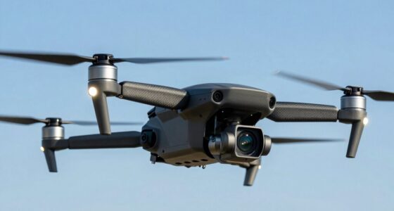
Have you ever wondered how drones are transforming the way we create detailed 3D maps and models? With photogrammetry, drones have become essential tools for aerial mapping, giving you the ability to capture high-resolution images from multiple angles quickly and efficiently. This technology allows you to generate accurate, all-encompassing representations of terrain, structures, and landscapes that were once difficult or time-consuming to produce. When you utilize photogrammetry with drones, you gain access to a level of detail and precision that considerably enhances your evaluation process. The key advantage lies in data accuracy—by capturing overlapping images from various perspectives, the drone’s onboard systems and photogrammetric software work together to stitch these images into precise 3D models. This process reduces errors and ensures that measurements you rely on are trustworthy, which is critical whether you’re assessing construction sites, surveying land, or monitoring environmental changes.
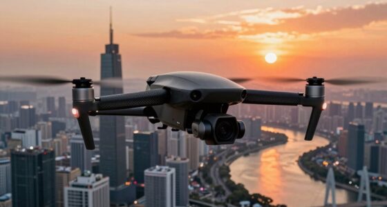
Using drones equipped with photogrammetry, you can perform aerial mapping at a scale and speed previously unimaginable. Instead of manual surveys or satellite imagery, which can be limited by resolution or cloud cover, drones fly lower and collect data with much higher detail. You can plan your flights to cover specific areas, capturing images at just the right angles and altitudes to maximize data quality. This targeted approach means your maps and models are not only more detailed but also more accurate, allowing you to make informed decisions based on reliable information. The real-time feedback you get from drone imagery helps you quickly identify discrepancies, evaluate progress, or identify potential issues before they escalate. Additionally, advancements in photogrammetric software have made processing even more efficient, enabling faster project completion. Improved data processing workflows further streamline the entire evaluation process, saving you time and effort. Furthermore, understanding the principles behind biodiversity conservation can benefit from detailed spatial data generated through drone photogrammetry, supporting efforts to protect ecosystems.
Moreover, the automation of photogrammetric workflows simplifies data processing. Once your images are captured, software algorithms analyze the overlaps, extract features, and generate 3D point clouds, orthomosaics, and textured models. This seamless integration minimizes human error and accelerates your project timelines. As a result, you can evaluate the data more confidently, knowing that the models are precise and all-encompassing. The availability of open-source and commercial photogrammetric tools has further democratized access to this technology, making it more accessible to a broader range of users. Whether you’re conducting site assessments, environmental monitoring, or infrastructure inspections, the combination of aerial mapping and photogrammetry empowers you to produce detailed, accurate representations efficiently. This technological synergy not only improves data integrity but also elevates your capability to interpret and act upon the information, making drones indispensable in modern evaluation tasks.

DRONE PHOTOGRAMMETRY FOR REAL PROJECTS: MAPPING, SURVEYING, INSPECTION, AND 3D DATA WORKFLOWS
As an affiliate, we earn on qualifying purchases.
As an affiliate, we earn on qualifying purchases.
Frequently Asked Questions
What Are the Limitations of Using Photogrammetry With Drones?
Using photogrammetry with drones has limitations, especially regarding legal considerations and data privacy. You might face restrictions on capturing certain images, depending on local laws. Privacy concerns can also restrict where and how you collect data. Additionally, weather conditions and complex terrains can affect data accuracy. Always guarantee you’re compliant with regulations and respect privacy to avoid legal issues and optimize your drone’s photogrammetry capabilities.
How Accurate Is Drone-Based Photogrammetry Compared to Traditional Methods?
Drone-based photogrammetry is like a razor-sharp lens, offering impressive data accuracy, often within a few centimeters when properly calibrated. Your drone’s calibration plays a vital role in this precision, ensuring consistent results. While traditional methods can sometimes surpass drone accuracy in controlled environments, advances in drone calibration and sensor technology are closing the gap, making aerial surveys a reliable, efficient alternative for detailed evaluations.
What Types of Terrain Are Best Suited for Drone Photogrammetry?
You’ll find drone photogrammetry works best on terrains with diverse features and clear visibility. Flat, open areas like fields and construction sites yield highly accurate results, while varied terrain with different vegetation types, such as forests or agricultural lands, also benefits from detailed mapping. Avoid densely vegetated or heavily shadowed areas, as these can hinder image capture. Overall, terrain diversity enhances the quality and usefulness of your drone-based surveys.
How Does Weather Affect Drone Photogrammetry Data Collection?
Weather variability can considerably impact your drone photogrammetry data collection. Wind, rain, or fog can cause instability and diminish image clarity, making it harder to capture accurate data. Sunlight interference, such as harsh shadows or glare, can distort images and affect processing. To guarantee quality results, you should plan flights during stable weather conditions, avoiding extreme weather and times of intense sunlight for ideal data accuracy.
What Software Is Recommended for Processing Drone Photogrammetry Images?
You should consider software like Pix4D, DroneDeploy, or Agisoft Metashape for processing drone photogrammetry images. These tools excel at data processing and automatically handle image calibration to guarantee accurate 3D models and maps. They streamline workflow, improve precision, and make it easier to analyze your data. Using such software helps you efficiently turn your raw images into detailed, reliable geospatial information.

Drones with Camera for Adults 4K 1080P, Mini Drone with Camera, Altitude Hold, One Key Take Off/Landing, Headless Mode, 3D Flip, 3 Speed Mode, Foldable Remote Control Drone with 2 Batteries for Beginners
Drone with 1080 HD Camera: This mini drone is equipped with a 1080P HD camera that supports a…
As an affiliate, we earn on qualifying purchases.
As an affiliate, we earn on qualifying purchases.
Conclusion
Imagine flying over a rugged landscape, capturing every detail with your drone’s camera. Thanks to photogrammetry, you now see the terrain like never before—precise, layered, and alive. It’s like upgrading from a blurry map to a detailed, 3D model. This tech transforms how you evaluate drones, turning raw images into powerful insights. Just as a sculptor sees potential in stone, photogrammetry reveals the full potential of your drone’s perspective.

GPS Drone with Camera for Adults, 2K HD GPS Drones with Auto Return, Follow Me, Circle Fly, Waypoint Fly, Optical Flow, Brushless Motor, Foldable 5G Transmission FPV Quadcopter
【2K HD Camera & 5G Real-time Transmission 】The 2K drone is equipped with a 90° electrically adjustable camera,…
As an affiliate, we earn on qualifying purchases.
As an affiliate, we earn on qualifying purchases.

Advanced Pilot Products Rotating Aviation Plotter – Precise Navigation Tool for Student Pilots – Ideal for FAA Exam & Flight Training – Durable, Lightweight – Fast Course Plotting & Wind Correction
Enhance Course Accuracy: The rotating aviation plotter from Advanced Pilot Products elevates your navigation experience by allowing precise…
As an affiliate, we earn on qualifying purchases.
As an affiliate, we earn on qualifying purchases.