Automated drone flights using waypoints let you plan precise routes for stunning aerial shots without manual control. You can set waypoints to guide your drone’s path, adjust angles, and create smooth cinematics effortlessly. These flights are safer and more efficient, as they consider obstacles and environmental factors, ensuring better footage and battery life. Keep exploring, and you’ll discover how to leverage these features for epic, professional-quality shots with ease.
Key Takeaways
- Waypoints enable precise, automated drone navigation for complex, cinematic aerial shots without manual control.
- Pre-programmed waypoints ensure smooth camera movements, altitude changes, and specific angles for epic visuals.
- Incorporating environmental data enhances safety and accuracy during waypoint-based autonomous flights.
- Preview and adjust flight paths before execution to align footage with creative vision.
- Well-designed waypoint routes save time, reduce risks, and produce professional-grade aerial footage.
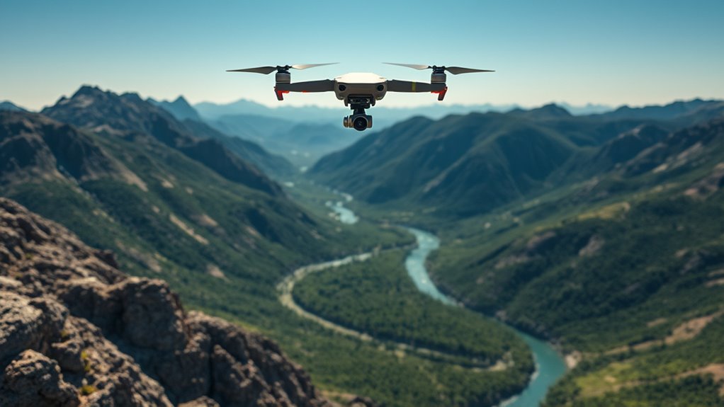
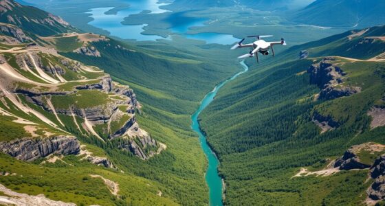
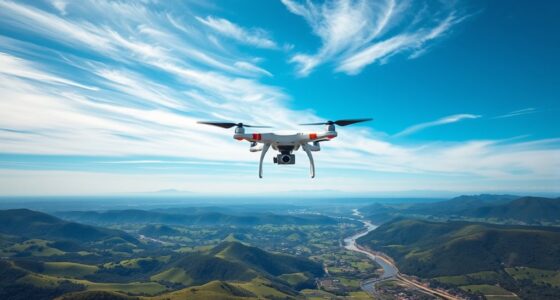
Automated drone flights are transforming the way industries operate by enabling autonomous navigation without human intervention. When you’re planning a flight, especially for capturing epic aerial shots, meticulous flight planning becomes essential. This process involves setting precise waypoints that guide your drone along a desired path, guaranteeing smooth, safe, and accurate footage. Proper flight planning helps you avoid obstacles, optimize battery life, and maintain consistent camera angles, all while reducing the risk of mishaps. As you prepare, consider environmental factors like wind, weather, and terrain to create a thorough plan that maximizes safety and efficiency. Incorporating European cloud innovation into your data management can further enhance the coordination and analysis of flight data for improved safety and performance.
Droning safety is at the heart of successful automated flights. When you automate your drone, you rely heavily on pre-programmed instructions and onboard sensors to keep it safe during the entire flight. This means your drone can detect obstacles, avoid collisions, and respond to unexpected changes without direct human control. But safety also depends on your initial setup—double-check all hardware, update firmware, and verify that your flight area is clear of hazards. Incorporating geofencing and no-fly zones into your flight plan adds an extra layer of security, ensuring your drone stays within permitted areas and avoids sensitive sites. When you prioritize droning safety, you minimize risks to people, property, and your equipment, making automated flights more reliable and efficient.
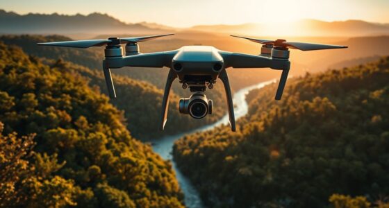
As you execute your flight, the importance of precise flight planning becomes even clearer. By setting waypoints, you control the drone’s movement, defining exactly where it should go and what it should capture at each point. This automation allows you to create complex, cinematic shots without constantly adjusting the drone manually. You can program smooth transitions, altitude changes, and specific camera angles, all tailored to your creative vision. With the right software, you can preview your flight path beforehand, making adjustments as needed to perfect your shot. This proactive approach reduces surprises during the flight, ensuring your footage turns out exactly as planned.
Ultimately, mastering flight planning and emphasizing droning safety pave the way for epic aerial shots that stand out. Automated drone flights save you time and effort, letting you focus on the creative aspects of your project. By carefully setting your waypoints and adhering to safety protocols, you gain confidence in your automated flights, producing stunning footage with minimal hassle. Whether you’re capturing sweeping landscapes or intricate architectural details, a well-planned and secure flight ensures your drone performs at its best, delivering breathtaking results every time.

Mini 3 / Mini 3 Pro Propeller Holder,Prop Strap Guard Protector Stabilizer for DJI Mini 3 Series RC Drone Accessories(Orange)
COMPATIBILITY - Specially designed for DJI Mini 3 / DJI Mini 3 Pro drone,prevent the drone from being...
As an affiliate, we earn on qualifying purchases.
Frequently Asked Questions
Can Drones Automatically Avoid Obstacles Along Waypoints?
Yes, drones can automatically avoid obstacles along waypoints. They use obstacle detection sensors to identify potential hazards in real-time, allowing the drone to adjust its flight path. Advanced flight path planning algorithms help create safe routes, but obstacle detection is essential for dynamic adjustments. This combination ensures smooth, safe navigation, even in complex environments, giving you peace of mind during automated flights.
How Precise Are Drone Waypoint Navigation Systems?
Coincidentally, drone waypoint navigation systems are incredibly precise, primarily thanks to high GPS accuracy, often within a few centimeters. However, signal interference can affect this precision, causing slight deviations from planned routes. You’ll find that modern drones compensate for these issues with advanced algorithms, ensuring your shots stay accurate and smooth. So, while not flawless, waypoint navigation generally provides reliable, pinpoint control for epic aerial shots.
What Is the Battery Life Impact During Long Automated Flights?
During long automated flights, your drone’s battery life is critically affected by battery consumption and power management. As the flight duration increases, the drone uses more energy to maintain stability and reach waypoints. Efficient power management helps extend flight time, but you’ll notice a gradual decrease in battery life, so planning for recharges or battery swaps is essential to avoid unexpected landings. Always monitor battery levels closely to guarantee safe operations.
Are There Legal Restrictions for Automated Drone Flights?
You need to check local regulations before flying your drone automatically. For example, in many areas, laws restrict automated flights over private property or near airports. Ensuring legal compliance helps you avoid fines and legal issues. Privacy concerns are also critical; you might need permits if your drone captures images of private land. Always review regulations and respect privacy laws to keep your automated drone operations safe and lawful.
How Do Weather Conditions Affect Waypoint Accuracy?
Weather variability, especially wind drift, can greatly impact your waypoint accuracy during drone flights. Strong winds may push your drone off course, making it harder to follow precise waypoints. Rain or fog can also interfere with GPS signals, reducing positioning reliability. Always check current weather conditions before your flight, and consider adjusting your flight plan or delaying your shoot if wind drift or other weather factors seem likely to affect your drone’s accuracy.

Arzroic Propeller Holder for DJI Air 3/3S Accessories, Propeller Guard Strap for DJI Air 3S/Air 3 Drone Propellers, Propeller Protector Stabilizer and Fixator
Accessories for DJI Air 3S/3, the propeller holder/guard is specially customized for DJI Air 3S and DJI Air...
As an affiliate, we earn on qualifying purchases.
Conclusion
With automated drone flights guiding your camera through precise waypoints, you become the captain of your aerial adventure. Think of it as orchestrating a symphony where every note hits perfectly, creating breathtaking shots effortlessly. As you set your waypoints, you’re charting a course through the skies, turning complex maneuvers into a smooth flight. Embrace this technology, and watch your epic aerial visions unfold like a masterpiece painted across the horizon.
Amazon Product B09J2HQL1G
As an affiliate, we earn on qualifying purchases.

Propeller Holder Compatible with DJI Lito 1 / X1, Slim Design Prop Stabilizer for Travel & Storage
Compatibility: Precision-cut to fit Lito 1 / X1 drones, the holder securely locks folded propellers without scratching the...
As an affiliate, we earn on qualifying purchases.