TL;DR

Get the latest gadgets delivered free with Prime
- Fast, free delivery on millions of items
- Prime Video, Amazon Music and more included
- Member-only deals all year
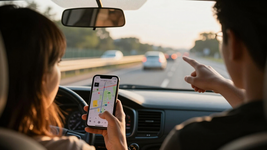
MapQuest has added a Surveillance Layer to its app that shows known locations of automated license plate readers and other outdoor surveillance cameras, including Flock Safety devices. The company has not explained where its location data comes from or how complete and current the map is.
MapQuest has added a Surveillance Layer to its navigation app, letting users view known locations of automated license plate readers, including cameras made by Flock Safety, as well as other outdoor surveillance equipment. The optional map overlay expands the app’s available information about roadside infrastructure, but MapQuest has not said how it gathers or verifies the locations.
The feature is available through the MapQuest app’s Map Options, where users can switch it on with a toggle. The company describes it as an overlay for known outdoor surveillance cameras and plate readers, using an interface similar to the app’s options for showing traffic and reported road incidents. The layer is separate from the standard navigation view unless users choose to display it.
In a post announcing the feature on October 15, MapQuest listed equipment associated with Flock Safety, Motorola Solutions’ Vigilant, Genetec, Axis Communications, Axon, Leonardo’s ELSAG, Neology, Rekor, PlateSmart, Ubicquia and Verkada, among others. That list describes the types of systems the layer is intended to cover; it does not establish that every device from those makers is mapped or that the locations shown are exhaustive.
Gizmodo reported that MapQuest had not specified its data sources and said it had contacted the company for more information. The report suggested the data may be similar to information collected by DeFlock, which maintains a user-submitted map of license plate reader locations, and could draw on DeFlock or OpenStreetMap. Those possible sources were not confirmed by MapQuest in the material provided.
A New View of Roadside Surveillance
The layer gives drivers and other app users a way to see reported camera and plate-reader locations alongside map information. Automated license plate readers capture vehicle plate data, and making known sites visible can help people understand where such equipment may be operating. The feature may also make it easier for users to contribute to public discussion about the spread of roadside monitoring.
Its practical value depends on the quality of the underlying map. A location can be missing, outdated, or imprecise, and the announcement does not say whether MapQuest checks user reports against other records. The layer is a display of known locations, not a complete inventory or an official record of all surveillance equipment. Users should not treat it as proof that a camera is present or absent at a particular place.
The announcement also extends MapQuest’s recent visibility beyond routine navigation. The company has attracted attention for decisions about disputed place names, giving it a public identity distinct from larger map services. The new overlay adds a feature with a different focus: showing surveillance infrastructure, rather than only roads, traffic or points of interest. It is not yet clear whether the addition will change how many people use the app or how the company plans to maintain the information.
license plate reader detection camera
As an affiliate, we earn on qualifying purchases.
As an affiliate, we earn on qualifying purchases.
MapQuest’s Recent Public Profile
MapQuest, a long-running online mapping service, has recently received renewed attention after pushing back against federal place-name changes. According to Gizmodo, the company declined to adopt the Trump administration’s “Lake America” name for Lake Ontario, while Google and Apple changed their map labels after the federal Geographic Names Information System was updated. MapQuest had also resisted changing the Gulf of Mexico’s name to “Gulf of America,” instead offering a Gulf Name Generator, the report said.
Gizmodo reported that MapQuest’s stance on the lake name was followed by a surge in downloads, with the app reaching the top spot in Apple’s App Store and recording millions of downloads. The new surveillance overlay follows that period of attention, though the announcement does not connect the feature to the company’s earlier naming decisions or state that it was designed as a political response. The immediate confirmed development is the addition of a user-controlled map layer.
“Turn on the Surveillance Layer in Map Options to see known license plate readers from Flock Safety, Motorola Solutions (Vigilant), Genetec, Axis Communications, Axon, Leonardo (ELSAG), Neology, Rekor, PlateSmart, Ubicquia, Verkada, and other outdoor surveillance cameras.”
— MapQuest, in its October 15 announcement
outdoor surveillance camera system
As an affiliate, we earn on qualifying purchases.
As an affiliate, we earn on qualifying purchases.
Data Sources and Map Accuracy
MapQuest has not publicly explained the data pipeline in the source material: whether locations come from company research, public records, user submissions, partner datasets, or a combination. Gizmodo raised DeFlock and OpenStreetMap as possible sources, but that remains speculation unless MapQuest confirms it.
Other key details are also unavailable. The announcement does not state when locations were last checked, how users can report errors, whether MapQuest removes or verifies reports, what geographic areas are covered, or how precisely the map identifies a device’s position. It also does not clarify whether the layer distinguishes between camera types or shows ownership and operating status. The listed manufacturers should not be read as confirmation that every camera they make appears in the app.
smart security camera with night vision
As an affiliate, we earn on qualifying purchases.
As an affiliate, we earn on qualifying purchases.
MapQuest’s Next Data Details
The next substantive update would be an explanation from MapQuest of where the locations come from and how they are maintained. Gizmodo said it had contacted the company for further information and would update its report if it received a response; the provided source material contains no answer. More information about coverage, correction requests and update frequency would help users judge how much confidence to place in individual map entries.
For now, users can turn the layer on from Map Options and inspect the locations available in their area. Whether MapQuest will add more detail, open a reporting channel, or expand the feature is not stated. The feature’s reach and reliability will depend on future disclosures and on how the data changes over time.
As an affiliate, we earn on qualifying purchases.
Key Questions
What has MapQuest added?
MapQuest added an optional Surveillance Layer in its app that displays known locations of automated license plate readers and other outdoor surveillance cameras.
Does the layer include Flock Safety cameras?
Yes. MapQuest named Flock Safety among the systems covered by the feature, along with equipment associated with several other manufacturers. The announcement does not say that every device from those companies is mapped.
How do users turn it on?
Users can enable the overlay through Map Options in the MapQuest app. It uses a toggle, similar to the controls for traffic and reported road incidents.
Where does MapQuest get the camera locations?
MapQuest has not identified its data sources in the source material. Gizmodo suggested DeFlock or OpenStreetMap might be involved, but that possibility has not been confirmed.
Is the map a complete or verified list?
There is no confirmation that it is complete or independently verified. MapQuest describes the locations as known sites, and has not disclosed its coverage, update schedule or verification process.
Source: fediverse
Halloween Picks
halloween
As an affiliate, we earn on qualifying purchases.