
Using maps to scout locations helps you plan your drone photo shoots more effectively. You can identify the best vantage points, analyze terrain features, and predict lighting conditions in advance. This approach saves time in the field, reduces surprises, and guarantees you target the most promising spots. By pre-visualizing your shots with maps, you’ll be able to maximize your in-air time and capture high-quality images. Keep exploring to learn more tips for successful planning.
Key Takeaways
- Use satellite imagery to identify promising shooting spots and assess terrain features like water bodies and open areas.
- Review topographic maps to evaluate elevation changes, landmarks, and potential hazards for safe drone navigation.
- Mark takeoff and landing zones on maps to streamline equipment setup and flight planning.
- Analyze shadows and lighting patterns at different times to optimize shot angles and scene composition.
- Anticipate obstacles such as power lines or dense forests to avoid hazards and ensure smooth drone operation.
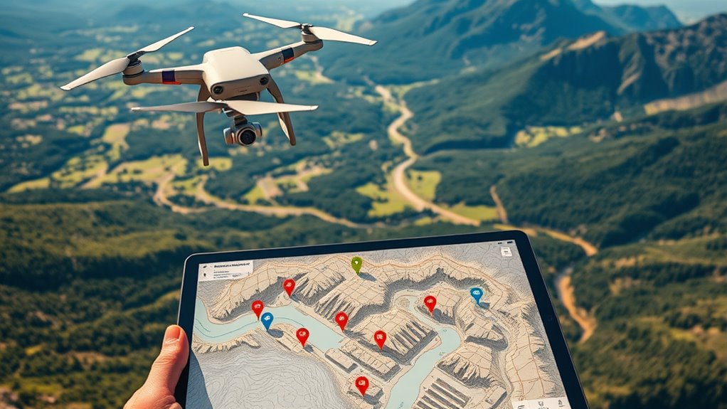
Drone photo shoots have revolutionized the way you capture stunning images from unique perspectives. When you’re planning a shoot, one of the most important steps is scouting the location effectively. Using maps to identify promising spots helps you visualize the area from above and plan your shots carefully. With maps, you can pinpoint vantage points that offer the best aerial perspectives, guaranteeing your drone captures the scene exactly how you envision it. This approach saves you time in the field and allows you to strategize for lighting, obstacles, and composition before even taking off.
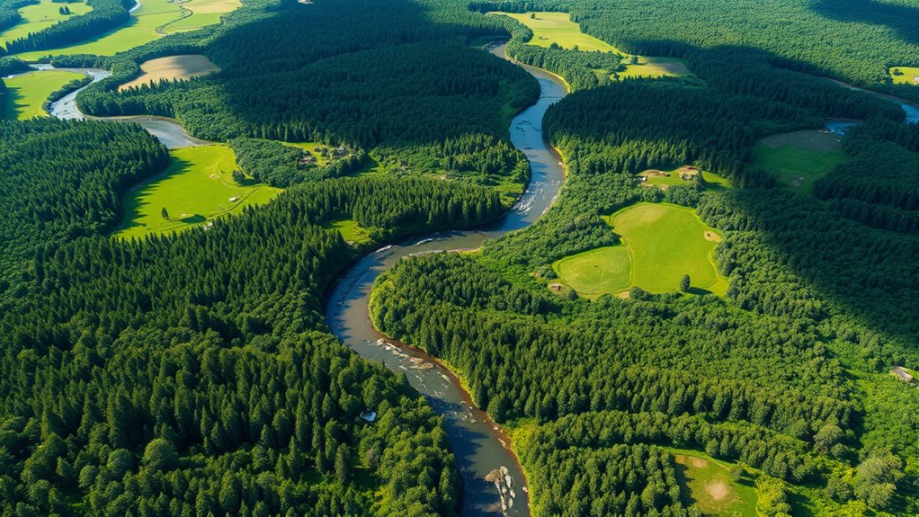
Before heading out, review satellite imagery or detailed topographic maps of your chosen area. These resources give you a bird’s-eye view of the terrain, helping you identify key features like water bodies, hills, or open fields that could make for compelling imagery. You can also assess accessibility and potential hazards, such as power lines or dense forests, which are essential for safe drone operation. As you plan, consider how different times of day will affect lighting and shadows, and mark potential locations for takeoff and landing, so equipment setup becomes seamless.
Equipment setup is indispensable to optimize your drone’s capabilities for capturing the best aerial perspectives. Make sure your drone is fully charged, and check that your camera settings are tailored to the lighting conditions of your chosen locations. Carry additional batteries and memory cards, so you’re prepared for extended shoots. When setting up your equipment, verify that your drone’s GPS and obstacle avoidance systems are calibrated and functioning properly—this minimizes risk and allows for smooth, stable flights. Also, consider the wind conditions and weather forecast, as these factors influence your equipment setup and safety. Additionally, using a high-quality projector can help review footage on-site in real-time, ensuring you capture the desired shots before leaving.
Using maps during your planning process gives you a strategic advantage. It allows you to pre-visualize your shots, anticipate challenges, and streamline your equipment setup. When you arrive on location, you won’t waste time figuring out where to go or how to position your drone; instead, you’ll be ready to execute your plan efficiently. This preparation guarantees you maximize your time in the air, capturing those perfect aerial perspectives that make drone photography so compelling. Ultimately, combining detailed map scouting with meticulous equipment setup empowers you to create stunning, professional-grade images from above, turning your vision into breathtaking reality.
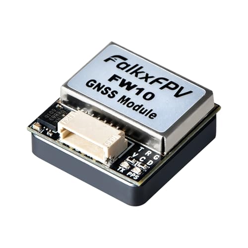
FPV GPS Module with QMC5883L Compass, Upgraded Dual Protocol 10th Chip Drone GPS,Fast Satellite Positioning for RC FPV Drone Racing Fixed-Wing
Upgraded 10th Generation Chip: Adopting the new 10th generation chip, with high sensitivity, low power consumption, miniaturization
As an affiliate, we earn on qualifying purchases.
As an affiliate, we earn on qualifying purchases.
Frequently Asked Questions
How Do Weather Conditions Affect Drone Mapping Accuracy?
Weather conditions considerably influence your drone mapping accuracy. Adverse weather patterns like rain, fog, or strong winds can cause visibility issues, making it difficult to capture clear images and maintain stable flights. These factors can lead to blurry or incomplete maps. Always check weather forecasts beforehand and choose days with stable, clear conditions to guarantee your drone operates at its best and produces precise, high-quality mapping data.
What Legal Considerations Should I Be Aware of When Scouting Locations?
You might think legal stuff is a hassle, but ignoring it risks fines or confiscation. Always check privacy laws before flying, ensuring you respect people’s rights and avoid legal trouble. Also, verify permit requirements for your chosen location—some areas demand special permissions. Staying informed and compliant keeps your drone activities smooth, safe, and enjoyable, giving you peace of mind to focus on capturing stunning shots without legal worries.
How Can I Optimize Battery Life During Extensive Map Scouting?
To maximize battery life during extensive map scouting, focus on battery conservation and power management. Turn off unnecessary features like Wi-Fi and Bluetooth, reduce drone camera usage, and lower the drone’s flight speed to save energy. Plan your routes efficiently to minimize flying time, and carry spare batteries for extended sessions. Keeping your drone well-maintained and pre-calibrated also guarantees peak power performance, helping you cover more ground without draining your batteries quickly.
What Are the Best Apps for Satellite Imagery and Map Planning?
You might be surprised to learn that Google Earth and DroneDeploy are top apps for satellite imagery and map planning. They give you detailed views of potential locations, helping you scout effectively before flying your drone. These tools allow you to analyze terrain, identify obstacles, and plan your shot routes precisely. Using them guarantees you select the best spots, making your drone photography more efficient and successful from the start.
How Do I Ensure Safety When Flying Over Unfamiliar Terrain?
You should conduct a thorough risk assessment before flying over unfamiliar terrain to identify potential hazards. Always plan and rehearse emergency procedures like GPS failure or loss of signal. Keep your drone within visual line of sight, and check local regulations. Carry a first aid kit, and inform someone of your flight plans. These steps help guarantee safety and quick response in case of emergencies.

Drone Mapping Starter Guide: Plan Flights, Capture Aerial Images, and Create Practical Site Maps for Real Projects
As an affiliate, we earn on qualifying purchases.
As an affiliate, we earn on qualifying purchases.
Conclusion
With meticulous mapping and mindful scouting, you make magic happen from above. Embrace exploration, expand your expertise, and elevate every shoot with enthusiasm. Planning propels your projects, producing powerful, picturesque pictures that pop with passion. So, seize the skies, stay spontaneous, and let your creativity soar. When you combine careful cartography with courageous confidence, your drone photography reaches new heights—highlighting horizons and heartening your hobby into a breathtaking, bold pursuit.

Gimaibugraff 29"/75 cm Drone Landing Pad – Foldable Landing Pad and Waterproof Launch Pad, Drone Landing Platform with Carry Bag, Mat Landing, RC Quadcopters, Vs FPV Drones Accessories
1.Precision Done Landing Zone: 21-inch Landing Zone is specifically designed for mini and folding drones. Accompanying reflective strips…
As an affiliate, we earn on qualifying purchases.
As an affiliate, we earn on qualifying purchases.

Drone with Camera for Adults LCD Screen FPV Live Video, Brushless Motor 270° Obstacle Avoidance 3D Flips, Foldable RC Mini Drones for Kids Beginners 32G SD Card Max Under 250G Gifts for Boys and Girls
【Drone with Camera for Adults】Although the TT19LCD is not a drone with 4K camera, it features a FPV…
As an affiliate, we earn on qualifying purchases.
As an affiliate, we earn on qualifying purchases.